STUART MILLSON reports from semi-rural England
The earliest settlement to have occupied the ground that we now know as East Malling, Kent, is thought to have been Roman, although who knows what band of ancient Britons wandered and settled the area before the Legions and arrow-straight roads came to our shores. Fragments of stone from Roman buildings may be found in the fabric of the village church – the Church of St. James the Great; a Norman and mediaeval structure which itself occupies the site of an Anglo-Saxon place of worship. Criss-crossed by streams (which powered the village’s mills of the 19th-century) the present-day village is a place which still preserves a country identity, notwithstanding the traffic jams which often bring the narrow High Street to a standstill, rendering the 20mph speed signs redundant.
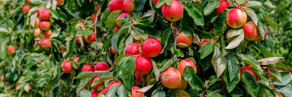
Climb the church tower of St. James the Great Church and you will see East Malling surrounded by its very own greenbelt: a playing field, known as the South Ward Playing field, complete with a rim of ancient trees and a brick-built cricket pavilion, dating from AD 1985; the Bradbourne estate, dominated by the Queen Anne-era Bradbourne House; and most importantly, the large expanse of experimental orchards and fields, created in the First World War as the East Malling Research Station – still a body of national importance and world-leader in the field of horticulture. And finally, close to the railway line (built in the middle of the 19th-century), the Cottenham Orchard – once a place of abundant fruit trees, but now – due to the trees being unattended for some 30 years – an unexpected Nature reserve. Today, the former orchard is trying to become a woodland. Rewilding itself, the orchard is now home to a new generation of walnut trees and oak saplings – all threaded together by dense blackberry bushes. A few fruit trees do manage to survive and the pattern of the orchard can still be discerned, but it is likely, in time, that any semblance of the well-ordered apple and pear trees of the past will completely disappear.
Despite this Kent village-redoubt possessing such a green hinterland, the area in which East Malling is situated is now facing major challenges to its identity as a part of the semi-rural England of the South East. I use the expression, semi–rural, because a significant part of the countryside of Kent exists almost as fragments, compressed by growing towns such as Ashford and Tonbridge, and falling to the gradual, oil-slick-like creep of housing in-filling – the effect of which can be seen along Maidstone’s so-called M20 corridor. Here sits East Malling and its beleaguered neighbours, Ditton, Aylesford and Larkfield – the latter long since sacrificed to the will of the planners.
Most recently, conservationists and residents have been forced to abandon their usually quiet lives in order to join the fight for two areas adjoining their village: the Forty Acre field, separating East and West Malling, and the former hamlet of Leybourne, a pleasant community but made up largely of the modern brand of typical 1980s’ out-of-town housing. And southwards from East Malling and Leybourne is the area of Broadwater Farm, a commercial fruit-growing area, but with many ancient landscape features, such as deep holloways – lanes which seem to take you into a tunnel through the earth. The high sides of the holloway (at Broadwater Lane) provide an instant geology lesson for passers-by: strata of ancient rock and ragstone, all held together by ancient roots.
Despite a valiant effort by the letter-writers and organisers of protest meetings, Forty Acres will fall to housing: a blob of 250 properties (no doubt, the cul-de-sacs and closes named after the trees and butterflies they have crushed). Broadwater, meanwhile, is intended to provide no fewer than 900 houses – a vastly disproportionate housing allocation even for a community in the South East. Described as “land north of Kings Hill” (Kings Hill being the local equivalent of Milton Keynes – a new town built on West Malling’s old RAF aerodrome) the development is, in fact, a major encroachment into the countryside and existing village and community life.
Often described by its proponents as bringing much-needed housing, the reality is that the four or five-bedroom houses that will fill up the fields of the South East offer little or no provision for local families, workers or younger people who depend upon non-London wages. The over-development of the South East will, instead, absorb the large numbers of metropolitan dwellers, understandably eager to leave behind the congested suburbs and sprawl of Greater London, but who – in heading for the relative security of the Home Counties – bring with them the very conditions they wished to escape. And there is a rootlessness about the ‘new-build’ areas: a sense of a suburbia, suddenly planted in country fields – quite different from the slow growth of a small hamlet to the size of a large village, an organic process that barely registers on the consciousness of the local people from one lifetime to another.
The disappearance of the traditional contours of the landscape beneath the new suburbia also empties a place of an element less easy for the developers and council planners to understand: the spirit of a place. In East Malling’s case, this is the legacy of the ancient (and now extinct) Twisden family, whose names are carved into the memorials of the church in which they worshipped since before the Civil War. Then there is the First World War officer, married at St. James the Great on an early summer’s day in 1917, but whose tragic death in the last year of the conflict is commemorated on the church’s north wall; and then, just outside, over by the last-surviving pub in the village, the traces of the 18th-century estate which continues to remind us, emphatically, how the village belongs to Kent, to England – and not to the faceless world of a housing deluge threatening to obliterate the character of our countryside, forever.

STUART MILLSON is a member of the Chartered Institute of Journalists, and a Contributing Editor to The Brazen Head